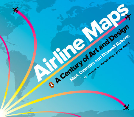
http://www.penguinrandomhouse.com/books/600815/airline-maps-by-mark-ovenden-and-maxwell-roberts/
Mark Ovenden et Maxwell Roberts reviennent sur quelques idées intéressantes mises en avant dans leur ouvrage lors d'une interview pour Citylab (The Rise and Fall of the Exuberant Airline Map) :
- Mark Ovenden, Transit Maps of the World, 2007 (réédition 2015).
- Maxwell Roberts, Underground Maps Unraveled, 2012.
En complément
Affiches vintage de compagnies aériennes :
http://www.pinterest.fr/dzarail/affiches-compagnies-a%C3%A9riennes-vintage/
Classic Airline Route maps :
http://www.pinterest.fr/johndupont948/classic-airline-route-maps/
Affiches publicitaires d'Air France :
http://www.airfrancelasaga.com/fr/content/publicit%C3%A9
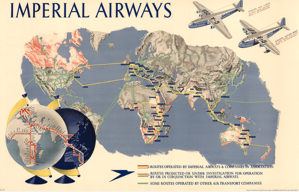
The history of Imperial Airway :
http://industrialhistoryhk.org/the-history-of-imperial-airways/
Cartes et images de l'Aéropostale :
http://www.pinterest.com/pin/621778292274748132/?lp=true
Une compagnie aérienne : une affiche de voyage : Air France 🇫🇷
— Le Cartographe (@lecartographe) May 15, 2021
« Vers des ciels nouveaux » pic.twitter.com/SmMnjm97Ab
— MapPorn (@MapPornTweet) November 29, 2019
Vintage 1928 map shows the Imperial Airways flight path from London to Paris. From a different era when flying was much more special (elitist) and dangerous. Source: https://t.co/jY3ULh0Wrj pic.twitter.com/zHyeTdmHCD— Simon Kuestenmacher (@simongerman600) July 1, 2019
Amazing #map by Scandinavian Airlines System @SAS uses Spiral Polar Projection to show all routes offered. https://t.co/soqUtDTIA1 pic.twitter.com/7DLwAnyVJw— Simon Kuestenmacher (@simongerman600) August 20, 2017
A delightful hand-drawn cartoon celebrating Claude Grahame-White’s round-trip flight to Boston Light at the 1910 Harvard-Boston Aero Meet. #aviation #Cartoon #Harvard #Manuscript #quincymassachusetts https://t.co/ZjGv4z0iAM pic.twitter.com/5ftH6wlEHV— Boston Rare Maps (@bostonraremaps) January 13, 2020
With a certain post-war optimism, here the Caribbean as the unexplored, exotic playground. #oldmapgallery #oldmaps #Caribbean pic.twitter.com/xNFUgMGkp7— The Old Map Gallery (@OldMapGallery) January 15, 2020
Prendre l'avion, c'est mal. Ça pollue.— Norédine Benazdia (@Benazdia) January 15, 2020
Mais dans les années 1950, les compagnies aériennes ont tout fait pour séduire les passagers et les convertir à l'avion. Voler était une fête🍾🎉
Un #thread plutôt WTF à dérouler⤵️ pic.twitter.com/6y0gryUSZv
Voyager dans le monde : carte, imagination et invitation— Françoise Bahoken (@fbahoken) March 7, 2020
ht @ljegou cc : @lecartographe @nico_lambert pic.twitter.com/YEOCzx6YK1
Rêve de voyage 🧳— Le Cartographe (@lecartographe) April 12, 2020
Une carte, une affiche de voyage : l’orient pic.twitter.com/JmgnsgOHfY
Very elegant 1943 vintage map makes the point that in "the air age" we are no longer dependent on water or land to travel so they might as well not be shown. Source: https://t.co/BvYyoJGoAU pic.twitter.com/Dw8Eju1PDy— Simon Kuestenmacher (@simongerman600) May 25, 2020
"The Wealth of the Other Americas"
— Rumsey Map Center (@rumseymapcenter) May 27, 2021
Pan American World Airways, 1945
🗺https://t.co/T45OQFpmuO pic.twitter.com/qaSXxcz34e
Such style. For us, the maps that Lucien Boucher did for Air France were exceptional examples of his subtle elegance. A favorite from that series, this from 1962. #maps #mapporn #AirFrance pic.twitter.com/WU7cuyLGWs
— The Old Map Gallery (@OldMapGallery) October 20, 2021
A Pictorial History of American Aviation published in 1943 by Albert Richard Sportswear https://t.co/S0a4trVUbD #MapPorn pic.twitter.com/LqTecAkoiw
— MapPorn (@MapPornTweet) October 21, 2021
— World Travel Posters (@OrbisPeace) October 29, 2021
En terme de graphisme et d'exotisme, les affiches d'Air France des années 1950 étaient exceptionnelles. Voir la collection du Musée Air France sur Gallica. Des affiches utiles pour travailler sur le tourisme, le transport aérien, les représentations en géo https://t.co/SBPL5ZHMhJ https://t.co/BHDnSS6hql pic.twitter.com/k0q6sDEHtu
— Sylvain Genevois (@mirbole01) December 8, 2021
Un siècle d'#affiches du musée @AirFrance sur une #carte avec @GallicaBnF @IGNFrance #publicité #transport #aviation #voyager #macartehttps://t.co/MkgQEMdJLf pic.twitter.com/pUVS3ZxLQv
— Jean-Marc Viglino (@jmviglino) July 28, 2019
Quand l'essor de l'aviation faisait basculer la géographie dans l'ère aérienne
Visualiser les flux aériens et les aéroports avec Openflights
Le trafic aérien mondial représenté sous forme d'infographie animée
Calculer le bilan carbone de nos déplacements aériens
Les plans de métro : retour sur une représentation simplifiée, souvent détournée


