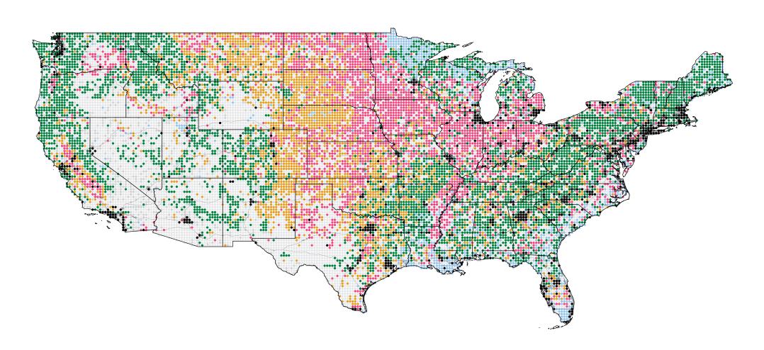
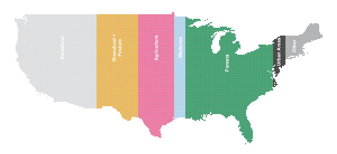
Signalé par Visual Capitalist, 14 janvier 2020 (Mapped : The Anatomy of Land Use in America).
Lien ajouté le 22 décembre 2020
La répartition des productions agricoles aux Etats-Unis : http://i.redd.it/qw0j1ymezm661.png
Where food is grown in the USA https://t.co/xZJDXS0QAG pic.twitter.com/m0UM4GXQ58
— The Big Data Stats (@TheBigDataStats) December 22, 2020
The "Statistical atlas of the U.S., based upon...the eleventh census" has many maps that detail farming stats in the U.S. such as the map below showing the average size of farms in 1890, along with maps on various other topics!
— LOCMaps (@LOCMaps) September 6, 2021
View the whole atlas here: https://t.co/CWM6JxTcVk pic.twitter.com/fYhdOFwBj5
Liens ajoutés le 7 octobre 2024
Have you ever wondered how the US Agricultural Landscape has evolved over the past 15 years?
— Mohsin Ramay (@mohsinramay_) September 19, 2023
My new map reveals the dynamic change in Agricultural land across the country.
🟢 = Growth in agricultural area
🔴 = Areas where agriculture receded#Agriculture #USA #BigData pic.twitter.com/rTscAwxQQN
Do you know how soil moisture in the U.S. interacts with agricultural land?
— Mohsin Ramay (@mohsinramay_) September 16, 2024
This map reveals fascinating patterns of regions with:
- High moisture and dense farms
- High moisture but little farmland
- Low moisture but thriving agriculture#Agriculture #SoilMoisture #GIS pic.twitter.com/GTKRwgkhqs
Déchiffrer l'information géographique à l'heure d'Internet
OneSoil, la carte interactive des parcelles et des cultures en Europe et aux Etats-Unis
Où sont les grands propriétaires terriens aux Etats-Unis ?
Données Corine Land Cover 2018 sur l'Europe
Comment la Suisse occupe son territoire
Cartes et données sur les forêts en France et dans le monde
Dynamic World : vers des données d'occupation du sol quasi en temps réel


